
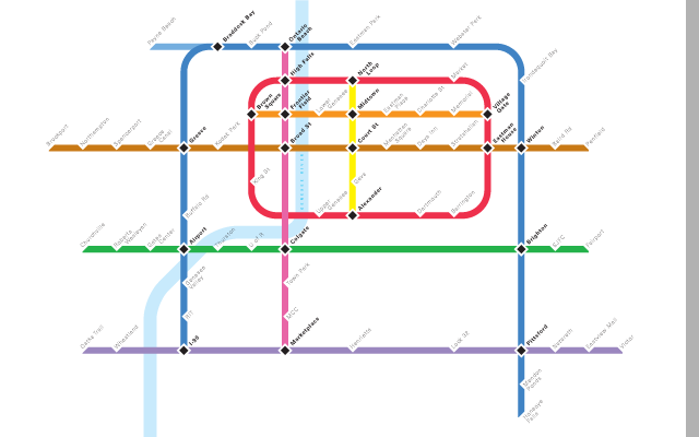
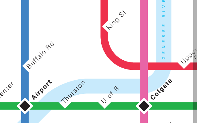
Conceptual Mapping
City of Rochester, New York (conceptual)
Problem
A conceptual plan to reinstate and expand a subway system in Rochester, New York required a route map showing what riders would use to navigate the system.
Solution
Drawing on the history of subway route maps, this map incorporates some design decisions that have been proven elsewhere and uses new information specific to Rochester. Since distance between stations matters less to the rider than the number of stations and interconnections, the map approximates the physical landscape but does not reproduce it to scale. Line color is based on activity, with more active lines using "warmer" colors.